First geologic map of Ganymede made with Voyager data
Ars Technica » Scientific Method 2014-02-24
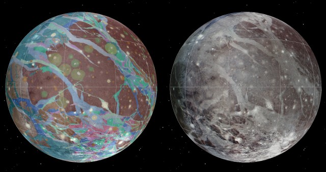
Maps have always been an integral part of exploration. They take the in out of terra incognita. Some things are easier to map than others, of course. The geology of a world a few hundred million miles away is one of those other things. Nevertheless, the United States Geological Survey just released a geologic map of Jupiter’s moon Ganymede—an icy satellite larger than Mercury.
The map was created through the hard work of a team led by Wheaton College’s Geoffrey Collins using imagery from the Voyager probes and the more recent Galileo mission. Much in the way that geologists can determine the relative ages of Earth rocks by noting which rocks cut into or through others, Ganymede’s surface can tell us about its own geologic history.
The researchers identified three basic periods in that history, which they named the Gilgameshan, Harpagian, and Nicholsonian periods. The oldest is marked by an abundance of impact craters, the second by extensive tectonic activity that altered and deformed the surface, and the youngest by an absence of significant activity.
Read 1 remaining paragraphs | Comments