Sea level rise will make Hurricane Sandy's NYC typical by the year 2200
Ars Technica » Scientific Method 2012-10-30
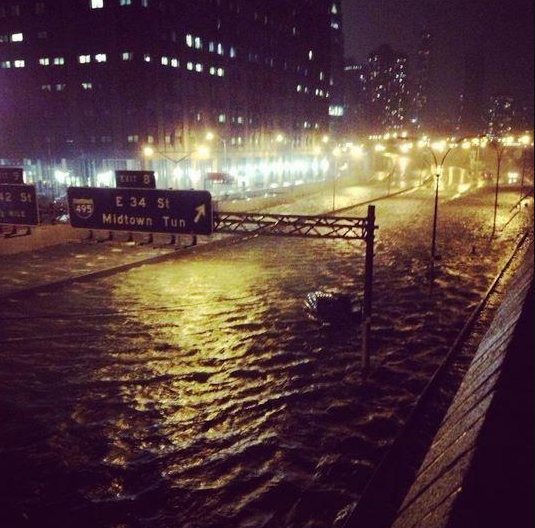
Photos of various parts of New York City underwater due to Hurricane Sandy have abounded over the last 24 hours: subway stations submerged, water pouring into Ground Zero, and the FDR Drive merged with the nearby river. But these events might not be an aberration in the future. According to various climate change models, the ocean will rise to the highest levels brought on by Hurricane Sandy within the next couple hundred years. We could be looking at a preview of the New York City of 2200.
Granted, predictions of the sea level beyond the year 2100 have wide confidence intervals, and depend greatly on variables like greenhouse gas emissions and how quickly some of the larger ice sheets in Greenland and the Antarctic melt. But even allowing for the world to get its emissions under control within a reasonable time frame, New York will still see the water level rise by several feet, as it did during the hurricane, within the next century or two.
According to the National Oceanic and Atmospheric Administration's water level sensor at The Battery in Lower Manhattan, water levels were 9.23 feet above normal at their highest point, which happened at about 9:24pm last night. The water level rise was sustained above five feet for about ten and a half hours, from 2:24pm on October 29 until 1:18am on October 30.
Read 4 remaining paragraphs | Comments