Ian reaches major hurricane status, will be a historic storm for Florida
Ars Technica » Scientific Method 2022-09-27
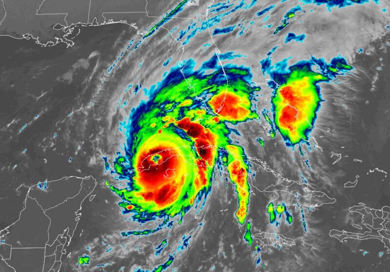
Enlarge / As of 5:50 am ET on Tuesday, Hurricane Ian had nearly traversed the island of Cuba. (credit: NOAA)
Hurricane Ian continued to intensify on Monday night and reached sustained winds of 125 mph as its center passed across the western edge of Cuba. From there, the storm will move into the southeastern Gulf of Mexico, where very warm water and low wind shear will allow for further intensification.
The hurricane has been moving around the western edge of a high pressure system, but as Ian approaches the western coast of Florida on Wednesday it will start to run into a trough of low pressure draped across the southeastern United States. The net effect of this will cause Ian to slow down, perhaps only moving a few miles per hour for a couple of days.
All of this is a recipe for disaster for much of the Florida peninsula, but it's difficult to say precisely where, and precisely which effects. Even though landfall is expected to occur in less than two days, there remains considerable uncertainty in where Ian will make landfall along the western Florida coast, and where it will go. This is due, in part, to the breakdown of its steering currents.