Your heatwave could be worse because of a drought somewhere else
Ars Technica » Scientific Method 2019-08-21
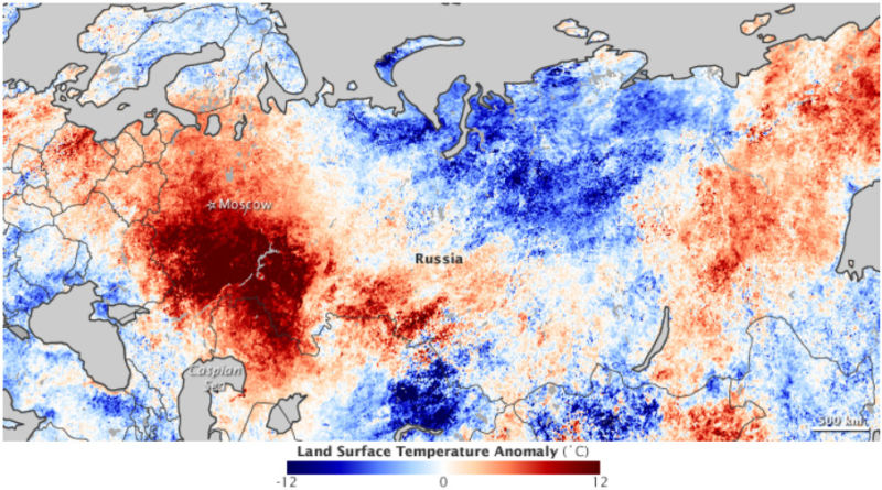
Enlarge / Temperatures during the third week of July, 2019. (credit: NASA Earth Observatory)
Long-lived heatwaves in the mid-latitudes are typically the result of an atmospheric pattern known as a “blocking high.” In a blocking high, the jet stream bends in a north-pointing ridge (in the Northern Hemisphere, anyway), creating an area of high atmospheric pressure as long as it stays bent. High pressure means air tends to sink towards the surface rather than rise, making it hard for any clouds to break up the blue sky. The blocking high also distorts the average wind directions as it brings warmer air from the south up to the north.
That’s the pattern that produced Russia’s incredibly deadly 2010 summer heatwave. Instead of westerly winds, warm air coming from Kazakhstan moved in on Moscow. One reason Russia got so hot during this time is that it was already in a drought. Similar to how the human body cools itself by producing sweat that evaporates off your skin, soil moisture limits how quickly the land surface can heat up. With the soil already dry, Russia lacked this cooling buffer.
A group of researchers led by Dominik Schumacher at Ghent University have now extended this idea upwind, showing that the heatwave was linked to drought in Kazakhstan’s neck of the woods, as well.
Read 7 remaining paragraphs | Comments