Plate tectonics vs. erosion—what sets the height of a mountain range?
Ars Technica » Scientific Method 2020-06-13

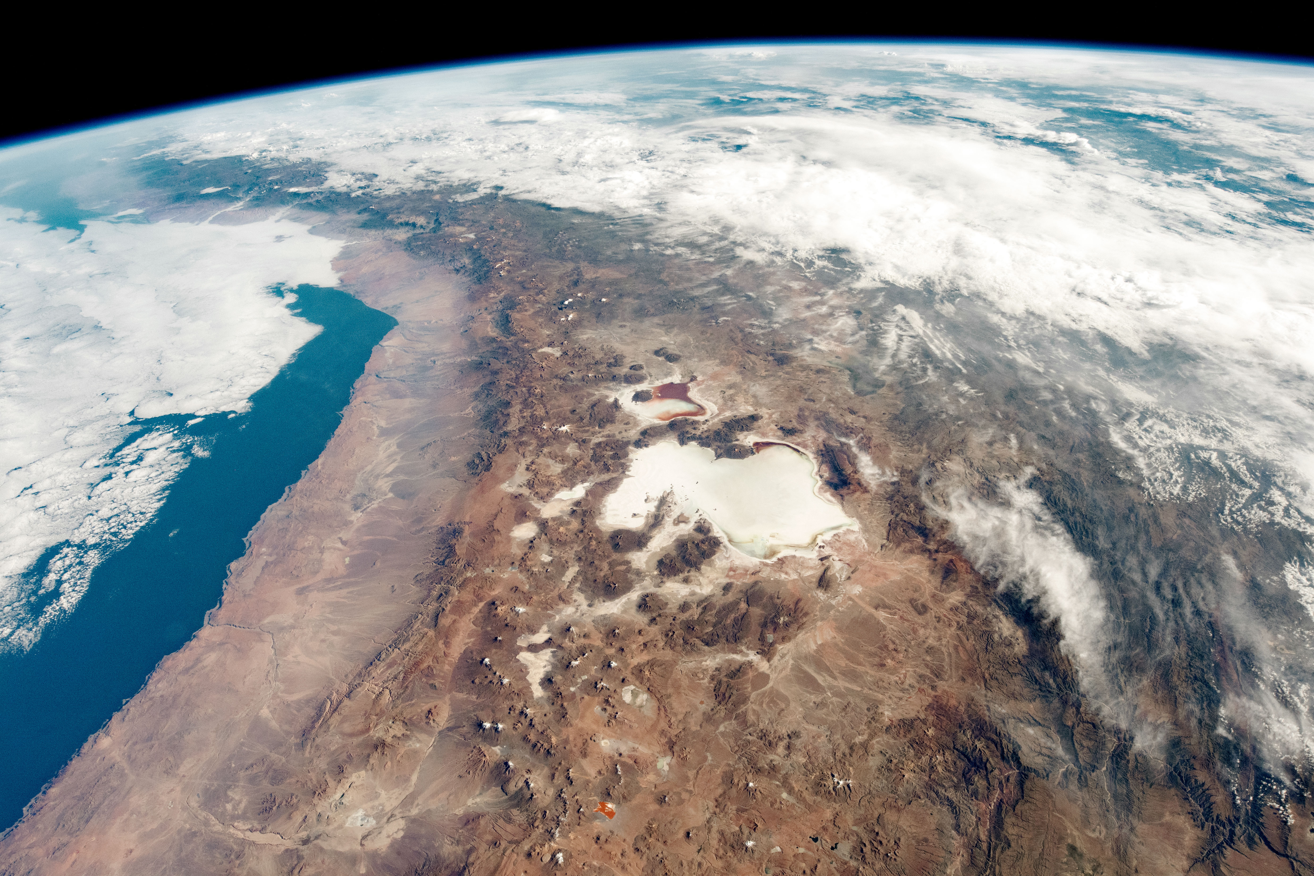
Enlarge / The Andes along the border of Bolivia and Chile, as seen from the International Space Station. (credit: NASA EO)
If you think about mountain ranges like the Andes or the Himalayas, you can come up with multiple factors that must affect their size and shape. There’s the collision of tectonic plates that squeezes them up into the air, of course. At a subduction zone where oceanic crust sinks downward beneath the continent, you can also sprout volcanos that grow skyward. On the other side of the ledger, various weathering and erosional processes sculpt the peaks. Streams cut sharp V-shaped valleys, while glaciers scrape out broad U-shaped ones instead. Either way, the end result is that the high places are gradually worn down, their rock scattered into the lowlands.
So what, exactly, is the primary control on the range’s height? Is it just a function of the plate tectonic forces? Or does climate dictate things by setting the rate at which the peaks are consumed?
This is an actual topic of considerable debate in geology, with arguments going both ways. A team led by Armin Dielforder at the GFZ German Research Centre for Geosciences wanted to test these hypotheses in a new way. The researchers set out to calculate the theoretical height of mountain ranges based purely on the tectonic forces. If erosion is dominant, you would see big mismatches between theoretical and actual heights—hopefully varying along with factors that influence erosion, like the climate.
Read 7 remaining paragraphs | Comments