Why Sandy's storm surge will pack an unusually strong punch in NYC
Ars Technica » Scientific Method 2012-10-29
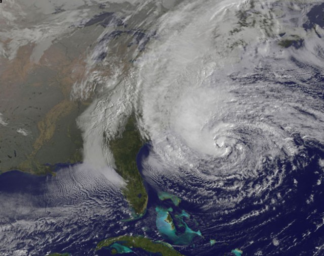
We tend to focus on watching wind speed as a hurricane approaches, but as the monster storm that is Hurricane Sandy is reminding us, it’s not the winds themselves that cause the most damage—it’s the storm surge. The waves that come crashing in look (and are) impressive, but the real problem is the higher-than-normal sea level that boosts those waves up onto the land.
This is mostly due to a fairly simple process—the constant and violent winds that push water landward and keep it piled up there. Think of blowing across the surface of a hot cup of tea. As long as you keep blowing, the “tea level” on the far side of your cup will remain higher. Since Hurricane Sandy is spinning, the storm surge will be focused on its northwestern side, where the winds are blowing toward the coast. That means northern New Jersey, New York, and Connecticut.
A NASA time-lapse of Sandy shows its rotation pushing a large band of clouds to the northwest. That will correspond to the area with the strongest storm surge.The angle at which the seafloor drops away from the coastline affects the size of the storm surge, as demonstrated by these animations on the National Hurricane Center’s website. The shallower the slope, the easier it is for wind to pile up the water since it’s unable to escape downward and back out to sea.
Read 4 remaining paragraphs | Comments