GigaPan's gigapixel images bring field trips to geology classrooms
Ars Technica » Scientific Method 2012-11-27
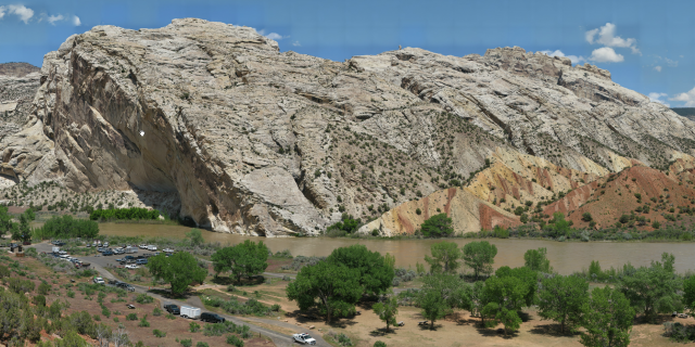
As I can attest firsthand, one of the biggest obstacles to getting students engaged in geology courses is being stuck in a classroom. It’s a science meant to be taken in by striding up hills and with a liberal application of hammers. And while it’s immensely beneficial to tackle the basic principles using simplified models and diagrams, it's hard to really appreciate them until you’ve seen them in the stony flesh, connecting with an unfamiliar Earth that's millions or even billions of years in the past.
In a world of tight class schedules and even tighter budgets, opportunities for excursions to the field are few, so the challenge is to bring as much of the outside world into the classroom as possible. Recently, a new tool has made it a little easier for educators to do just that.
That tool is the beautiful, explorable imagery created by GigaPan. The technology uses motorized mounts that guide a camera through snapping hundreds of high-resolution pictures that cover a predefined area. The images are subsequently stitched together to build a gigapixel (or more) scene that makes a standard panorama look like it came with a kids’ fast food meal.
Read 13 remaining paragraphs | Comments