EV charging update in Google Maps includes “AI-powered” station info
Ars Technica 2024-04-17
Enlarge / EV charger status is coming to Google Maps. (credit: Google)
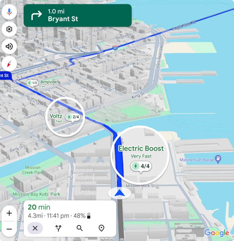
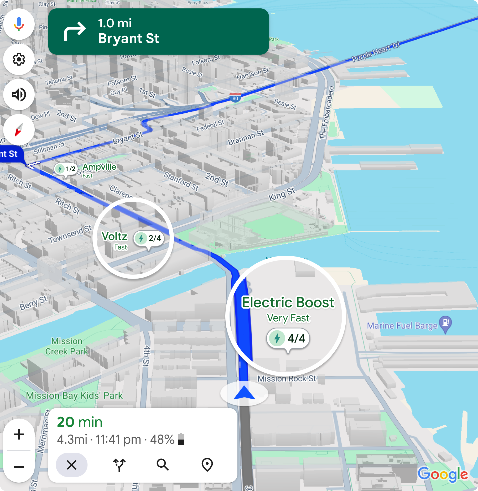
Google Maps is making itself friendlier for electric vehicles. A couple of years ago it added the option to select different powertrain types when calculating a route—gas, hybrid, electric, and so on. Lower-energy routes with fewer hills are helpful for electric vehicles, but mostly what EV drivers on unfamiliar terrain really want to know about are the chargers: Where are they, how fast are they, and do they work? Soon, that critical information will be available to Google Maps users via a new update.
Live charger status is usually available from the on-board navigation system built into an EV. Better yet, those native nav systems invariably talk to the powertrain, so they know how much state of charge is currently in the battery and how much to expect upon arrival. Add in real-time status on chargers—how many are working, how many are available—and it's not hard to see why plenty of EV drivers stick with the built-in system.
But for some EVs, that built-in system is Google Maps, including EVs from Ford, Honda, General Motors, Volvo, Polestar, and soon even Porsche. These will be the first devices to receive the update, Google says, which will roll out globally in the coming months. After the connected cars, smartphones will be next.