Why European forecasters saw Sandy’s path first
Ars Technica » Scientific Method 2012-12-28
Look, it’s not easy to predict the weather. And while it’s frustrating to have weekend plans spoiled by unexpected showers, the stakes are much higher for potentially catastrophic storms like hurricanes. The warning provided ahead of “Superstorm” Sandy’s arrival on the East Coast saved lives, without question, and that’s a success for weather science. But the story carries a reminder that there’s room for improvement in the US, where many argue forecasting tools have been neglected amid continual budget crunches.
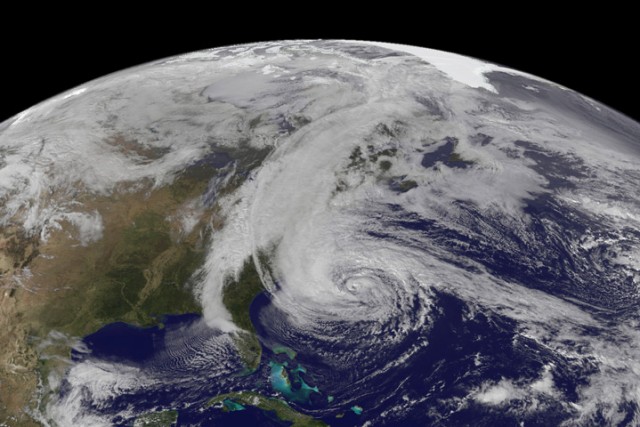
Seven days before Sandy made landfall in New Jersey, the atmospheric crystal ball was partly cloudy. The US National Weather Service forecast model showed a chance that Sandy might come ashore, but indicated that it was more likely the storm would spin off into the Atlantic. The European Centre for Medium-Range Weather Forecasts (ECMWF) model, however, definitely pointed the storm ashore. It would be about three days before the US model totally converged on the Europeans' forecast.
The fact that the National Weather Service was able to issue detailed warnings well ahead of Sandy is both a testament to what these amazing models are able to do, and the hard work of the professionals behind the scenes.
Read 14 remaining paragraphs | Comments