Mason, Dixon, and Latitude
The Endeavour 2025-12-23
A few weeks ago I mentioned that I was reading Stephen Ambrose’s account of the Lewis & Clark expedition and wrote a post about their astronomical measurements. James Campbell left a comment recommending Edwin Danson’s book [1] on the history of the Mason-Dixon line. I ordered the book, and now that work has slowed down for Christmas I have had the time to open it.
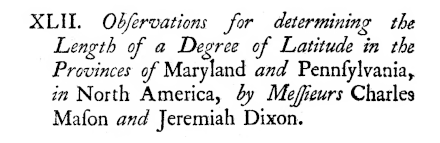
In addition to determining their eponymous line, surveyors Charles Mason and Jeremiah Dixon were also the first to measure a degree of latitude in 1767.
What exactly did they measure? We’ll get to that, but first we need some background.
The shape of the Earth
To first approximation a degree of latitude is simply 1/360th of the Earth’s circumference, but Mason and Dixon were more accurate than that. Isaac Newton (1643–1727) deduced that our planet was not a perfect sphere but rather an oblate spheroid. The best measurement in Mason and Dixon’s time was that the Earth’s semi-major axis was 6,397,300 meters with flattening 1/f = 216.8.
It’s a bit of an anachronism to describe the distance in meters since the meter was defined in 1791. The meter was originally defined as one ten-millionth of the distance from the equator to the North Pole along a great circle through Paris.
What exactly is a degree of latitude?
If the Earth were a perfect sphere, a degree of latitude would be 1/360th of its circumference. Using the original definition of the meter, this would be exactly 10,000,000/360 meters. But because the Earth is not a perfect sphere, each degree of latitude has a slightly different length. To put it another way, the length of a degree of latitude varies by latitude.
Another complication due to the flattening of the Earth is that there are multiple ways to define latitude. The two most common are geocentric and geodetic. The geocentric latitude of a point P on the Earth’s surface is the angle between the equatorial plane and a line between the center of the earth and P. The geodetic latitude (a.k.a. geographic latitude) of P is the angle between the equatorial plane and a line perpendicular to the Earth’s surface at P. More on the difference between geocentric and geodetic latitude here.
What did Mason and Dixon measure?
Since the length of a degree of latitude varies, we need to say at what latitude they measured the length of a degree. In short, they measured the length of a degree near what we now know as the Mason-Dixon line, the border between Pennsylvania and Maryland.
To be more precise, the starting point was Stargazer’s Stone, a stone placed by Mason and Dixon on John Harland’s farm near Embreeville, Pennsylvania, to a point about a degree and a half due south near what is now Delmar, a town on the Deleware / Maryland border.
I’ve had some difficulty determining how accurate Mason and Dixon were. Some sources I’ve found are obviously wrong. I haven’t verified this, but it seems Mason and Dixon overestimated the length of a degree of latitude at their location by only 465.55 ft or about 0.13%, a remarkable feat given the technology of their day.
Related posts
[1] Edwin Danson. Drawing The Line: How Mason and Dixon Surveyed the Most Famous Border in America. John Wiley & Sons. 2001.
The post Mason, Dixon, and Latitude first appeared on John D. Cook.