La Niña has returned and now the US might actually get some winter
Ars Technica 2016-11-13
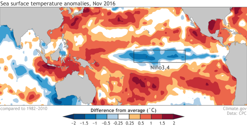
Enlarge / A weak La Niña has arrived. (credit: NOAA)
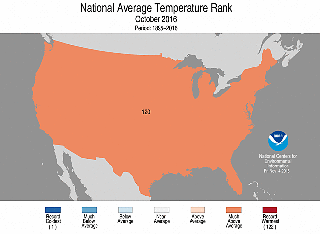
A relatively weak La Niña has developed, scientists with NOAA say, with lower than normal temperatures persisting across most of the eastern and central equatorial Pacific Ocean. This should eventually bring some cooler weather to parts of the United States, which just experienced its third warmest October on record.
Climate officials declared La Niña conditions this week after sea surface temperatures in the Niño3.4 region of the Pacific Ocean were about -0.7 degrees Celsius below average during October, and associated atmospheric conditions aligned with a La Niña pattern. Scientists say this slight La Niña has a 55 percent chance of persisting through January or February, but almost all of the forecast model guidance suggests it will end no later than the spring.
In contrast to El Niño, which increases the potential for severe weather across parts of the United States, La Niña's effects are typically more mild. It could mean drier weather and warmer than normal temperatures for the southern United States and wetter, cooler-than-normal weather for the northern plains through New England. These conditions are reflected in NOAA's official forecast for winter. There's no clear consensus on whether La Niña will benefit drought-stricken areas of California based upon past rainfall totals during analog winters.
Read 1 remaining paragraphs | Comments